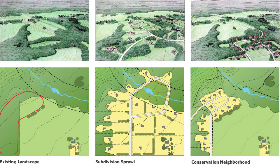
Existing Landscape
A few houses, many on existing or former farms, but an otherwise unspoiled/intact rural landscape.
Step 1:
- Require a map of the open space system for the parcel and surrounding area.
- Locate appropriate places for development.
- A sketch analysis of the area provides all the basic information to calculate how a development can fit into the landscape – what land should be protected and potential development pockets.
Individual parcels are developed for stand-alone, large lot houses which spread out across the landscape, degrading visual and environmental resources.
Step 2
Conventional sketch layout determines maximum lot count under existing three-acre zoning.
B. Typical Superimposed Subdivision
- Productive farmland lost forever.
- Pleasant view from road ruined.
- Stream corridor cut off by backyards.
- Large lots divide up and dominate the landscape.
- Individual roads for each subdivision.
- No chance for residents to enjoy special site features.
Conservation neighborhood
Development is concentrated in more compact neighborhoods, preserving the visual and environmental integrity of most of the landscape.
Step 3:
The same number of houses can fit into the landscape while preserving 80 percent of the open space.
C. Conservation Subdivision
• Large farm fields protected.
• Rural view from road retained.
• Trail system allows access to stream.
• Smaller, but substantial individual lot sizes with central green.
• Potential connection to adjacent parcel.
• Less expensive construction costs.
• Residents have views of open field and direct access to woods.
